Lidar record

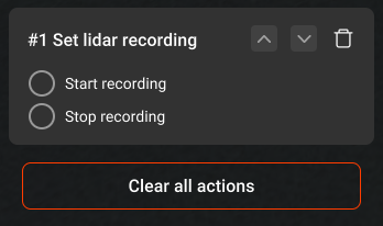
Lidar recording control - allows to start/stop the data recording at a specific waypoint. It’s available for
waypoints only.
Note: UgCS automatically starts data recording on DJI Zenmuse L1 at the first waypoint of a 'Lidar area” or “Lidar corridor” segment and stops data recording at the last waypoint of the segment.
Updated 8 months ago
Did this page help you?