How to export route for Autel Evo in .kml format from UgCS (Autel Explorer application Android only)
- Create a mission using UgCS and give it a friendly name, so it will be easier to find it later.

- Find the vehicle by typing in the first letters.

- Build the desired route.

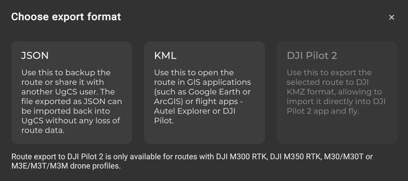
- To export the mission, go to Route card – Export, and choose the export format "KML".
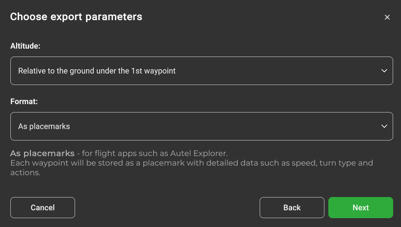
- Choose export parameters:
Altitude: Relative to the ground under the 1st waypoint
Format: As a linestring
- Save the mission somewhere on an Android device.
- Open Autel Explorer, and select “Mission”.

- Tap the indicated button to search for the exported mission.

- Look for the saved file and select it.

- The mission is now imported to the drone.

Updated 8 months ago
Did this page help you?