Advanced configurations
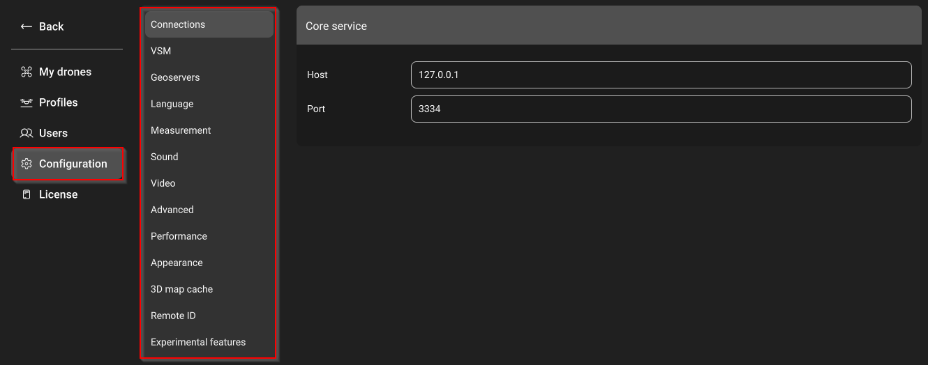
The Main menu of UgCS can be used to set up more configurations.

Connections
The Core service section defines the connection to the UCS server. By default, it points to the local instance. In the case of a multi-node deployment network, the address of the UCS server can be specified.
VSM
Records for each of the VSM servers. By default points to local instances. If using a dedicated VSM installation and want core services to connect to it, add a new record with the appropriate host and port fields.
Geoservers
Enable the option to add new geoservers or edit/remove the URL of existing geoservers.
Language
Select the language of the user interface. The most popular language of UgCS users is available.
Measurement
Choice of the measurement system as metric or imperial on the user interface.
Sound
Enables or disables the sound signals of UgCS. Sound signals are used to notify users about errors in the vehicle log.
Video
Allows editing the location of the video server.
Advanced
By the default, it enabled 2 options:
- Allow route and mission edit
- Automatically take vehicle control. When loading the application, opening a mission, and connecting the vehicle to UgCS, the control of the corresponding vehicles will be captured automatically. Other users will not be able to control vehicles until you release control or close UgCS.
One point is disabled by default:
- Enable Waypoint and Circle altitude change by dragging the pin head.
Performance
To decrease the performance of UgCS for battery saving enable the “Battery saving mode” flag. The “Battery saving mode” flag should be disabled for maximum performance.
To increase the performance of UgCS, enable the “Show 3D objects without textures” flag.
Appearance
- Full-screen option and scale factor adjustments.
- Option to turn on or turn off 3D avatar smoothing.
3D map cache
Option to edit the size of the cached map area or clear the map cache.
Remote ID
Option to add and edit drone operators to identify themselves during operation for Ardupilot/PX4 autopilots.
NOTE: DJI autopilots have this parameter automatically configured.
Experimental features
An experimental feature is one where the design is not finalized. Those features are available for users to test and provide feedback. Experimental features are not part of the officially delivered scope that SPH Engineering guarantees for future releases.
- Rangefinder for DJI M30 and Mavic 3 Enterprise series.

Updated 3 months ago
