LiDAR Calirbration

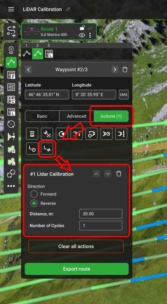
The IMU Calibration segment is a native DJI tool. It is only available for the DJI Zenmuse L1, L2 and L3 LiDAR sensors. It is a straight 30-meter-long line that the aircraft flies several times (depending on the segment location) with the maximum horizontal speed without changing the gimbal or aircraft heading. This segment is highlighted with blue colour during the planning.
The IMU Calibration may be added to the plan either as a separate action to a separate waypoint,
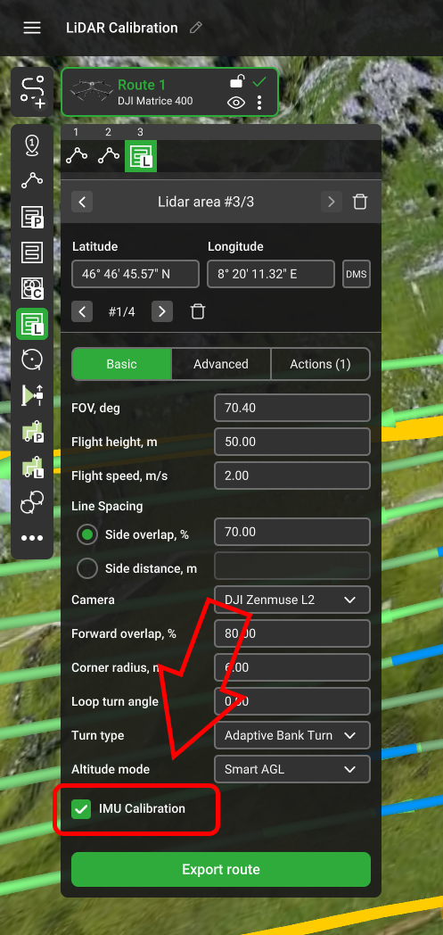
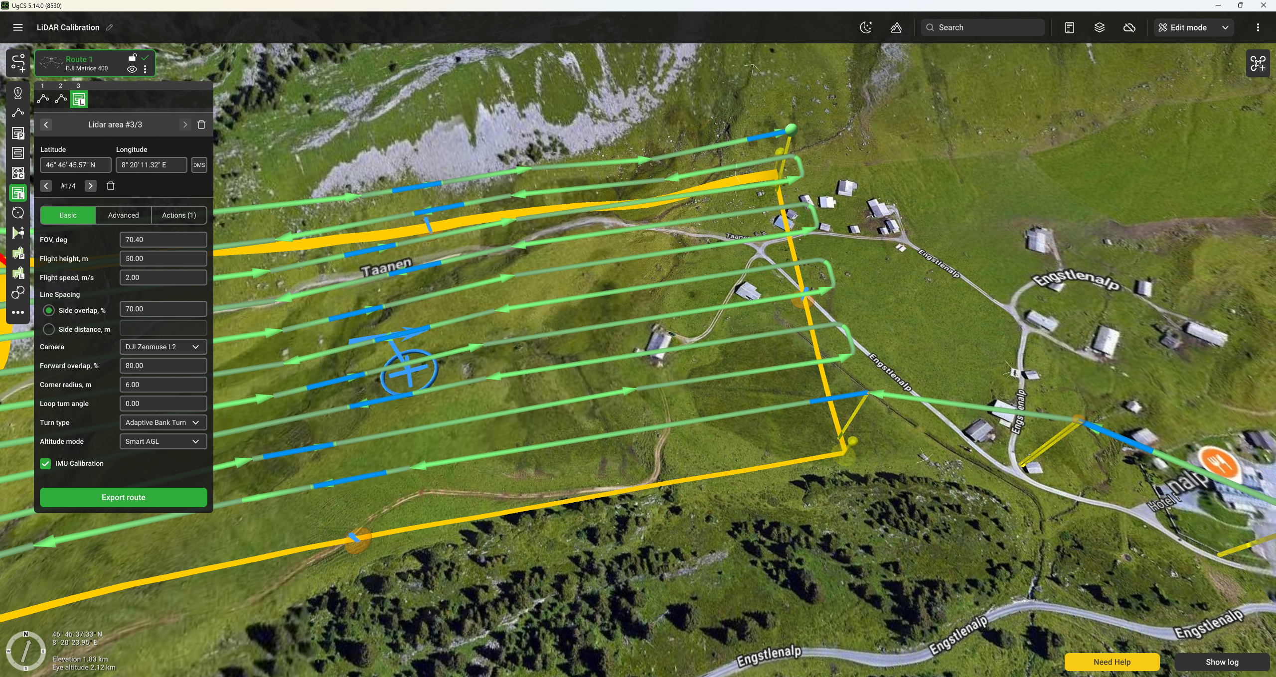
or as a parameter to the LiDAR Area and LiDAR Corridor.
If the IMU Calibration is enabled for the LiDAR Area or LiDAR Corridor, the calibration segments are added according to the following algorithm:
- One segment at the start and one at the end of the route. Such segments are executed three times.
- Additional segments every 100 seconds for L1 and 200 seconds for L2 and L3 during the straight line flight.
Note: According to the DJI specification, every turn that exceeds a 10° angle resets the timer.**
Updated 6 months ago