
Custom elevation layers (DEM, DTM, DSM)
UgCS allows adding custom elevation layers. Additional elevation data for a particular area (besides default elevation sources) can be imported from local files or an external link can be pointed out.
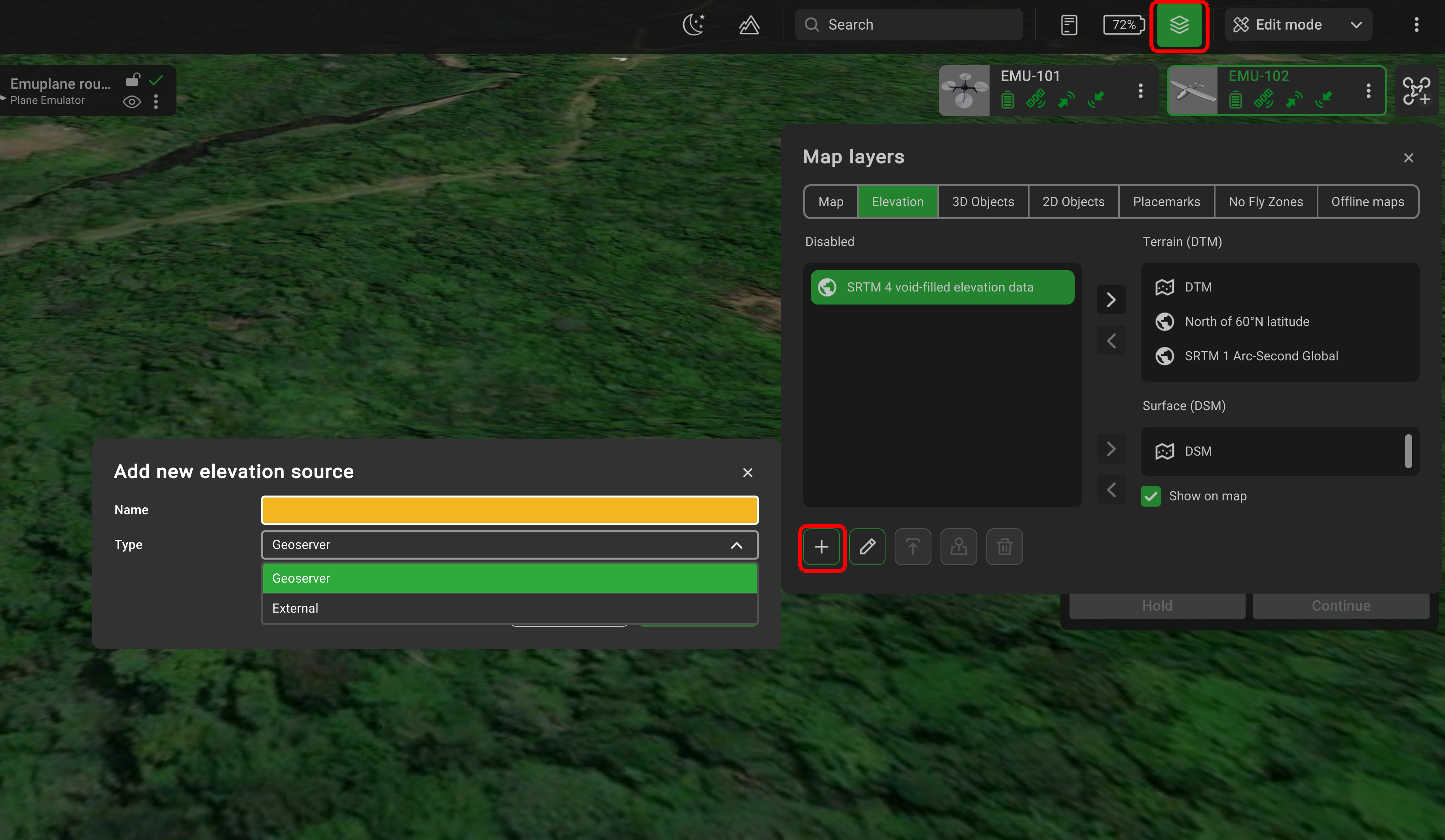
UgCS supports ArcASCII, GeoTiff, and SRTM formats, but all GDAL Raster Formats (more details) that feature Georeferencing should work. Built-in SRTM data in UgCS uses the WGS84 (EPSG:4326) horizontal datum and EGM96 vertical datum. UgCS accepts DEMs in any vertical datum and does not convert elevations on import, so using a datum other than EGM96 will produce an offset - and a visible step in terrain - where imported data meets the built-in SRTM.. High-resolution DEM data (< 1 m/px) is automatically downscaled to 1 m/px during import to improve performance.
Importing 3rd party elevation data from a local file.
- Click the Map options (globe icon at the top right-hand corner of the screen);
- Click on Map layers, and select Elevation;
- Click Add and create a unique name for the object;
- Select the created object and click Upload;
- Select the source of elevation data i.e. a recent orthophoto from a local drive.
The order of objects in the list is crucial because it determines the priority of the Terrain elevation shown on the map.
It is possible to change the source from enabled to disabled.
The «Focus» button displays the map of the imported object.
Importing 3rd party elevation data from an external source.
- Click the Map options (globe icon at the top right-hand corner of the screen);
- Click on Map layers, and select Elevation;
- Click add and create a unique name for the object;
- Select “type” and choose “external”;
- Indicate the link to the source and click “create”.
The order of objects in the list is crucial because it determines the priority of the Terrain elevation shown on the map.
It is possible to change the source from enabled to disabled.
The «Focus» button displays the map of the imported object.
Custom elevation data types
The custom elevation data may be of two types: Digital Terrain Model (DTM) and Digital Surface Model (DSM) with respective fields on the right side of the Elevations tab.
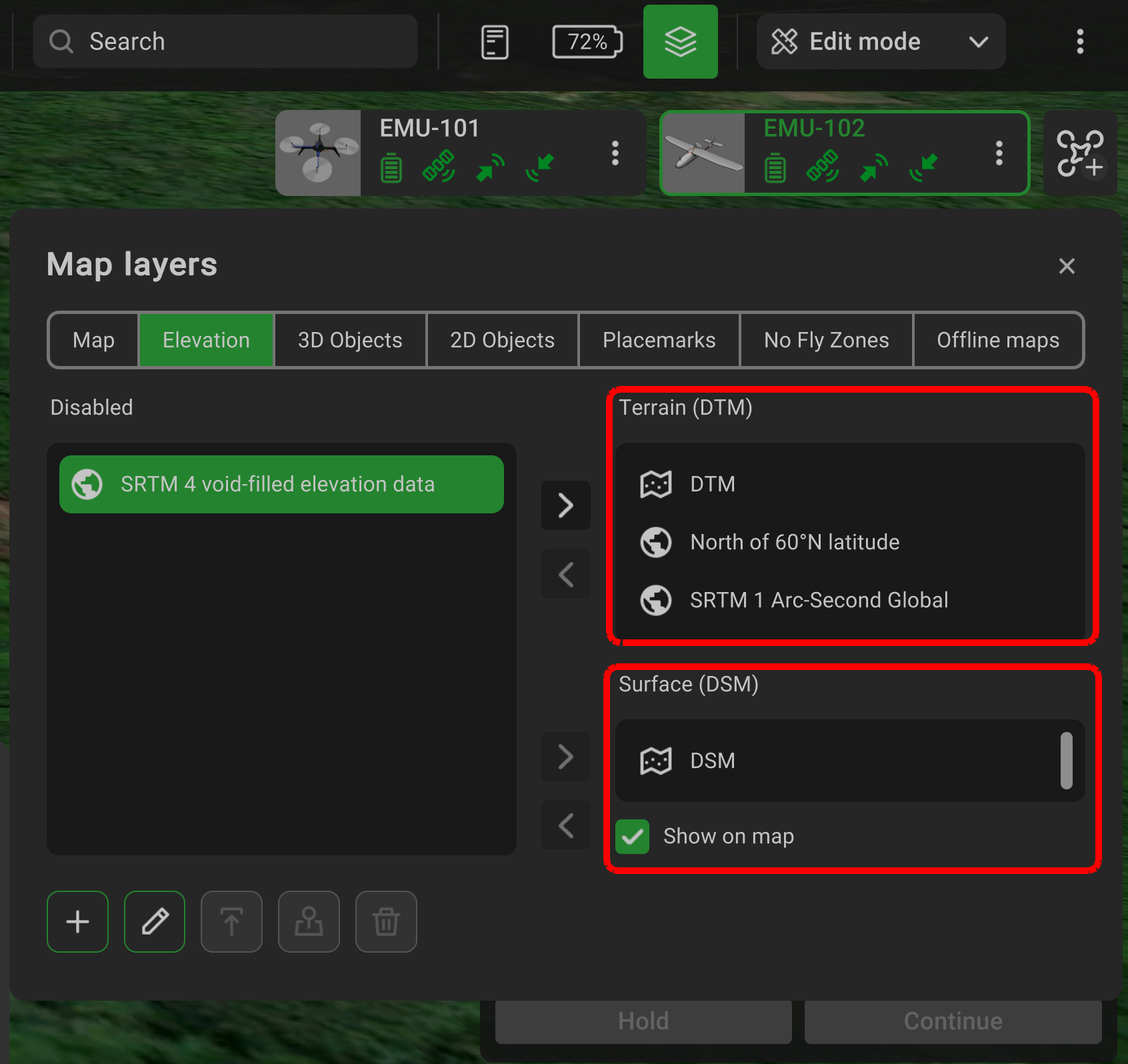
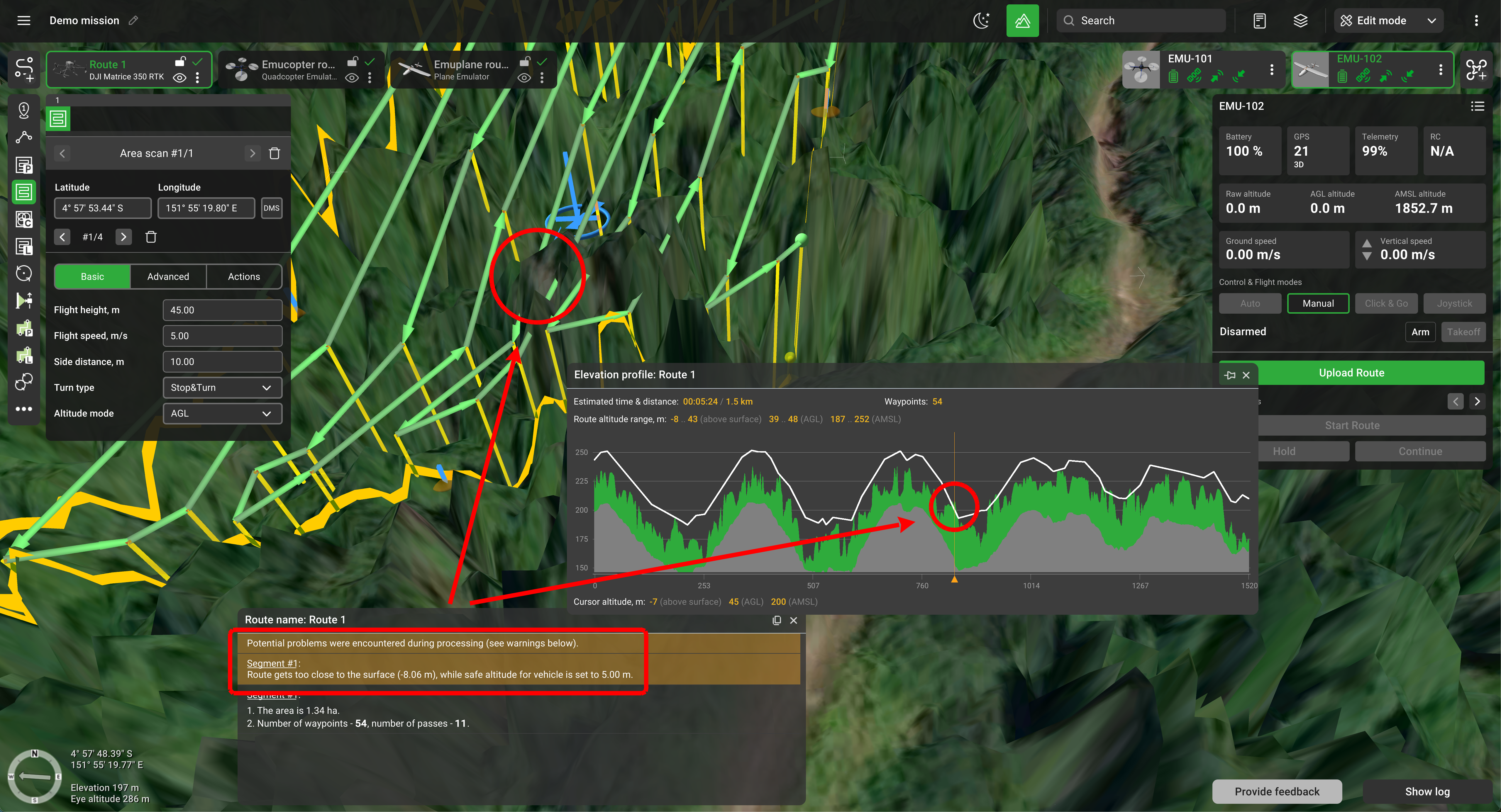
The DTM is used to calculate the route, whereas the DSM allows one to determine if there is a risk of collision with an object during the flight.
Updated 3 months ago