Exporting routes
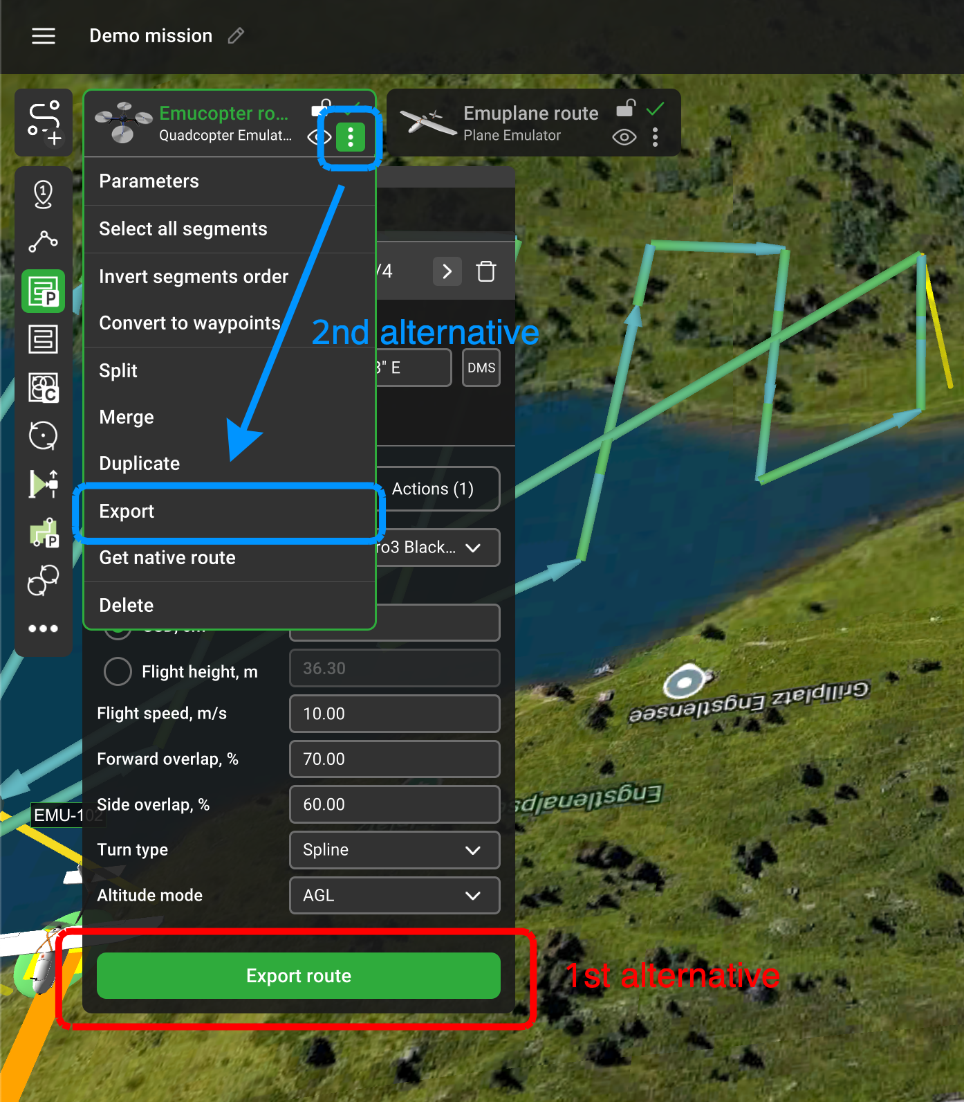
There are two alternatives for exporting routes: a button in the segment parameter window and in the common route parameters:

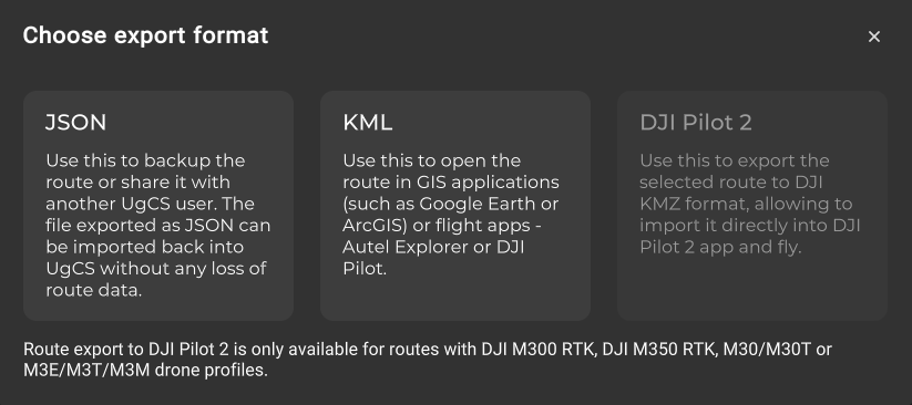
UgCS gives the possibility to export the route in 3 formats:

• JSON – can be imported back to UgCS
• KML – can be used for GIS applications, such as Autel Explorer or DJI Pilot
• DJI PIlot 2 – the ability to export routes from UgCS to DJI Pilot 2 (KMZ / WPML format). It is now possible to easily export any route planned in UgCS to DJI Pilot 2 and fly it with drones supported in DJI Pilot 2 - M300 RTK, M30, and Mavic 3 Enterprise.
This feature also exports all actions set in the route such as “Set camera by distance” or “Change camera tilt” as well as speed, turn type, and other relevant actions. The terrain model used in UgCS (default SRTM4 or custom DEM) is taken into account when exporting the route. This allows the route to be uploaded directly to the drone from DJI PIlot 2 and flown without any additional modifications.
This export feature can be accessed by clicking on “Export…” on the drop-down menu of any route and selecting the export option “DJI Pilot 2".
Important note: Routes are exported to DJI Pilot 2 with altitude relative to the take-off point. Make sure to take off from the first waypoint or a point at the same elevation to ensure a safe altitude above the terrain.
Updated 3 months ago
