Terrain follow
Supported for Ardupilot only.
-
If a vehicle is equipped with an altimeter then in the AGL field of the Telemetry Card the Client will display values from the altimeter, otherwise, values, are calculated by Server. The client determines from telemetry field altitude_agl, received from the S_FLIGHT_CONTROLLER subsystem if the drone has an altimeter or not.
-
Each route segment contains an Altitude mode attribute. Select one of the following values:
• AMSL - available for all platforms;
• AGL - available for all platforms;
• Range Finder - available for the Ardupilot platform only.
The last selected value is used when a new segment is created. If the last used value is not supported by the current platform or there is no last used value then AGL is used. -
Safe distance over terrain parameter is ignored during route calculation for segments with Range Finder altitude mode.
-
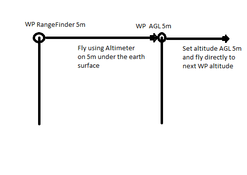
The drone follows terrain with an altimeter between the segment with Range Finder altitude mode to the next segment. If the segment itself contains a flight path (like an area scan) the drone will also fly this path using an altimeter to keep height over the terrain.

- To keep safe entrance in low-height segments (height < safe height over terrain), UCS requires it to be preceded by a segment with Range Finder altitude mode and on the safe altitude (height >= safe height over terrain). This restriction is required by the following example. The route consists of two segments:
- Waipoint: height = 10m, altitude mode = AGL.
- Areascan: height = 1m, altitude mode = rangefinder. The vehicle moves from the waypoint to the first the point of area scan without an altimeter. It will start using an altimeter only when it reaches the first point of the area scan. If GPS or elevation data is not accurate enough then the vehicle will crash.
-
Calculated flight path for Range Finder segments drawing features:
6.1. It has a specific color to highlight such segments.
6.2. Server resolves flight path with as few points as possible, Client inserts intermediate invisible points into the displayed flight path to make it close to the terrain landscape. -
If the uploaded route contains at least one Range Finder segment, VSM checks if the vehicle supports Terrain Follow Mode or not.
7.1. If the vehicle doesn’t support Terrain Follow Mode, VSM shows an error.
7.2. Otherwise, VSM sets up autopilot properly. Switch the vehicle to auto mode and the vehicle flies along the route. While flying the Range Finder section the vehicle keeps the same height from the terrain, regardless of obstacles. -
When a mission is paused on location WPP and then continued, the vehicle gets to WPP at the safe altitude (safe height over terrain in vehicle profile), then it gets WPP’s altitude and continues the route just as if it had flown the entire route.
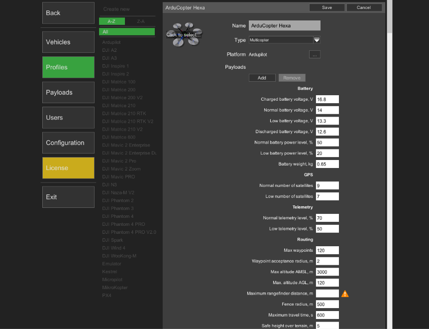
Note: See the rangefinder’s manual to set the correct maximum rangefinder altitude in the “Vehicle profile section”.

Updated 3 months ago
